Why Land Surveys Are the Foundation of Every Project
Before any building, fencing, or roadwork begins, one step determines how accurately everything else falls into place — the land survey plan. Whether you’re buying property, planning construction, or resolving boundary disputes, professional land survey services form the backbone of accuracy, legality, and safety.
In cities like Siliguri and North Bengal, where both urban and rural developments are expanding rapidly, having the right type of survey can save you from costly errors and legal complications later.
Let’s understand the different types of land survey plans and exactly when you need each.
What Is a Land Survey Plan?
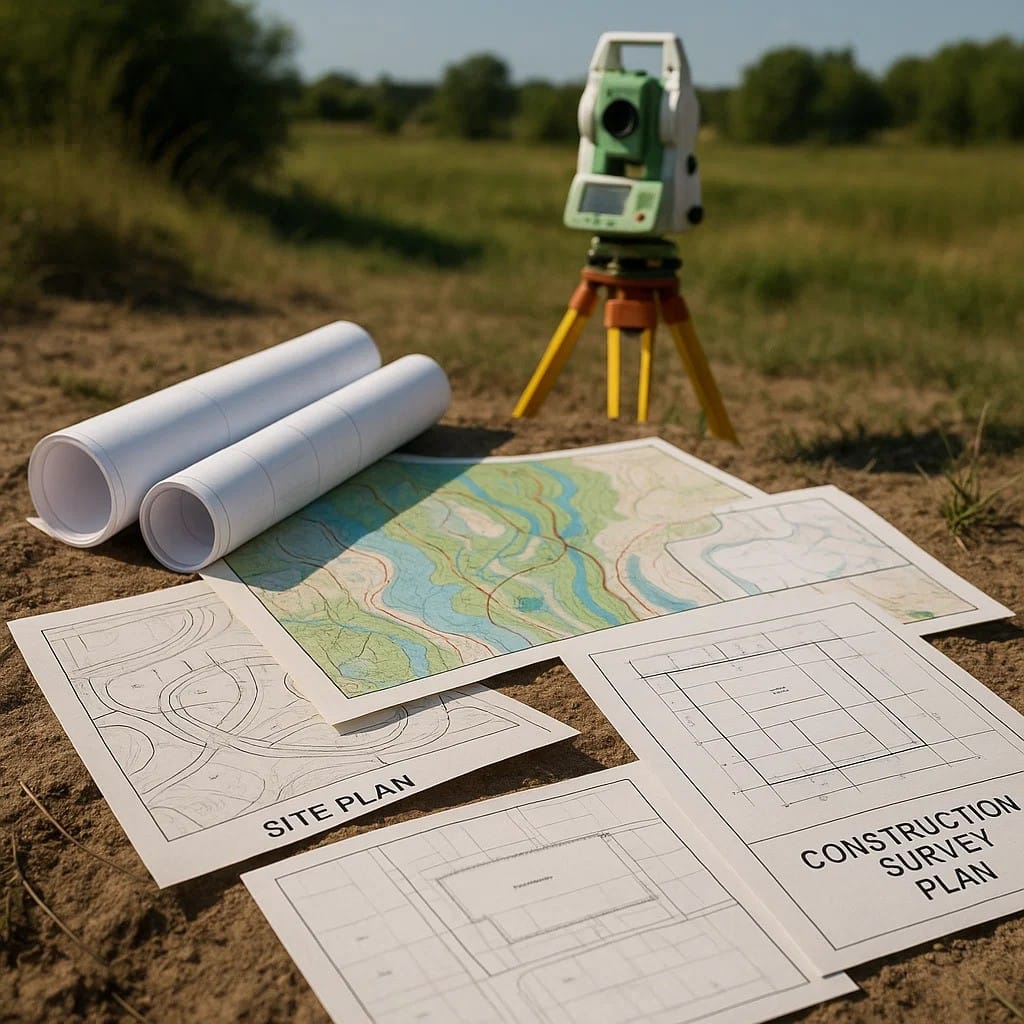
A land survey plan is a technical drawing that represents a piece of land’s dimensions, boundaries, contours, and physical features. It’s prepared by licensed surveyors using instruments like total stations, GPS, and drones.
Definition:
A land survey plan is an official document that maps out property limits, elevations, and structural elements, ensuring accurate planning, design, and compliance with legal standards.
These plans are crucial for construction, real estate transactions, and government approvals.
Main Types of Land Survey Plans (With Use Cases)
Type of Land Survey Plan | Purpose | When You Need It |
Topographical Survey | Shows natural and manmade features (trees, roads, buildings, slopes) | When planning construction, landscaping, or infrastructure projects |
| Boundary Survey | Defines exact property lines | Before buying/selling land or fencing a property |
Contour Survey | Shows elevation levels across the site | For building foundations, drainage planning, and road alignments |
| Site Plan Survey | Maps structures, utilities, and access routes | During building design or obtaining construction approval |
Subdivision Survey | Divides one parcel into multiple plots | When developing residential layouts or housing colonies |
| As-Built Survey | Verifies construction as per approved drawings | At project completion or for legal documentation |
Route Survey | Lays out paths for roads, pipelines, or power lines | For infrastructure and utility corridor projects |
| Cadastral Survey | Legally defines ownership and property records | For legal disputes or registration with municipal authorities |
Each of these surveys is tailored to a specific stage of your project — from concept to completion.
Top Land Survey Services You Should Know
Modern land survey services combine traditional techniques with technology to deliver accuracy and efficiency. Common services include:
- Drone-based aerial mapping – for large-scale and hard-to-access sites
- Total station surveying – for highly accurate measurement and plotting
- GPS-based land measurement – for rapid data capture and digital mapping
- GIS mapping and analysis – for integrating multiple survey datasets
These technologies help civil engineers, architects, and developers make data-driven design and construction decisions.
Read also: 2025 Home Design Trends: Modern, Minimalist & Budget-Friendly
When Should You Get a Land Survey Done?
Here are the most common scenarios where you should immediately hire a land survey consultant:
- Before Purchasing Property
To verify boundaries and avoid encroachments. - Before Starting Construction
To ensure your structure stays within legal limits. - For Renovation or Expansion
When adding floors or altering site levels. - For Legal and Government Approvals
Many municipal and registration authorities require updated survey plans. - Before Land Division or Development
To subdivide plots or apply for planning permissions. - After Project Completion
For preparing final “as-built” documentation for records or sale.
Why a Professional Civil Engineering Consultant Matters
While surveyors handle measurements, civil engineering consultants interpret the data to design safe, feasible, and code-compliant structures. The collaboration between civil engineering and architecture teams ensures your land survey plan is not just accurate — it’s actionable.
Professional consultants help in:
- Analyzing soil and topography reports
- Designing structural foundations based on terrain
- Estimating costs and managing resources efficiently
Without expert interpretation, even the most accurate survey is just a map — not a blueprint for success.
Conclusion: The Right Survey Today Prevents Headaches Tomorrow
A land survey plan is more than a technical requirement — it’s your project’s legal and structural foundation. Whether it’s a boundary survey for a home or a topographical survey for a commercial complex, knowing which type to choose (and when) ensures your project begins on solid ground.
At Elite Blueprints Consultancy, we provide end-to-end land survey services — from contour and layout plans to GIS-enabled topographic maps — tailored for every project type. Our team of engineers and surveyors ensures unmatched accuracy, timely delivery, and compliance with local regulations.
Get Your Land Survey Plan Done Right — the First Time!
📞 Call Us Today: +91-82500 86323, +91-90462 50581
🌐 Visit: www.ebcsiliguri.com
📍 Based in Siliguri | Serving India
Build confidently. Build on accurate data — with Elite Blueprints Consultancy.
FAQs About Land Survey Plans
Q1: How long does a land survey take?
It depends on the plot size and terrain complexity. Small residential plots may take 1–2 days, while large commercial areas can take up to a week.
Q2: Are land survey services expensive?
Not really. They are a one-time investment that prevents costly boundary disputes, fines, or redesigns later.
Q3: Who can provide a legal land survey plan?
Only licensed or government-approved surveyors and consultants can issue legally valid plans.
Q4: Can drone mapping replace manual surveys?
Drone mapping enhances accuracy and speed but is usually combined with ground-based measurements for best results.
Read also: Common Mistakes to Avoid in Commercial Building Plan Development
Read also: Construction Cost per Square Foot in Major Indian Cities


Comments are closed